


Stevenson étape 5

MMarie
Gebruiker
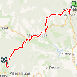

Lengte
28 km

Max. hoogte
1431 m

Positief hoogteverschil
828 m
Km-Effort
38 km

Min. hoogte
1020 m

Negatief hoogteverschil
626 m
Boucle
Neen
Datum van aanmaak :
2014-12-10 00:00:00.0
Laatste wijziging :
2014-12-10 00:00:00.0
7h53
Moeilijkheid : Moeilijk

Gratisgps-wandelapplicatie
 SityTrail
IGN / Geografische instituten
SityTrail Plus
De wereld gaat voor u open
Over ons
Tocht Stappen van 28 km beschikbaar op Occitanië, Lozère, La Bastide-Puylaurent. Deze tocht wordt voorgesteld door MMarie.
Beschrijving
La Bastide-Puylaurent aux Alpiers
20/O7/2012
Michel & Carmen
Plaatsbepaling
Land:
France
Regio :
Occitanië
Departement/Provincie :
Lozère
Gemeente :
La Bastide-Puylaurent
Locatie:
Unknown
Vertrek:(Dec)
Vertrek:(UTM)
571792 ; 4938093 (31T) N.
Opmerkingen